 ®

For planning & development professionals in England
Planning intelligence for professionals
Draw the red line once. In about a minute the constraints, the development plan and the appeals decided around the site come together, ready to export as a report under your own logo.
Free for 14 days, no payment card. Then £39 a month plus VAT, everything included.
- Every finding sourced and dated
- Desktop, iPhone and iPad, in sync
- Built by a chartered town planner

Planning History
BetaThe councils’ planning registers, on one map
More than 11.5 million planning applications from the councils’ digital registers, read in council by council. Choose an authority and search its register, or zoom in anywhere to see what has been applied for around a site.
- Search an authority’s register by address, reference or the words of a proposal, newest first
- Filter by outcome across the whole register, where the outcome has been read in
- Zoom in anywhere: the applications around a site, coloured by outcome, your own sites beside them
- A link to each application on the council’s own register, and its decision notice where we hold it
Each council’s digital register begins at a different date: we read them from 2006, or from the year a later one begins. Planning records go back to 1948, so for a site’s complete history the council’s own files are still the place to check.

Site appraisal
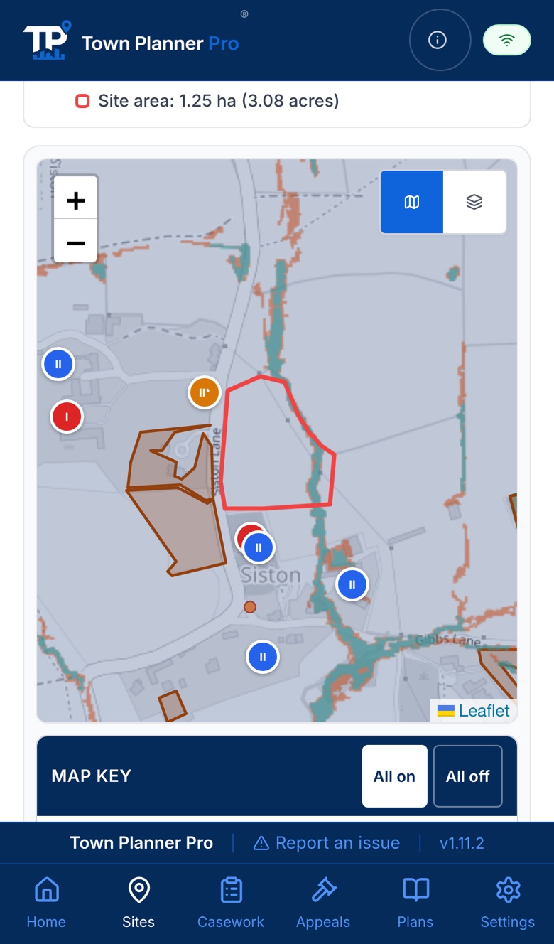
Draw the red line. The appraisal assembles around it.
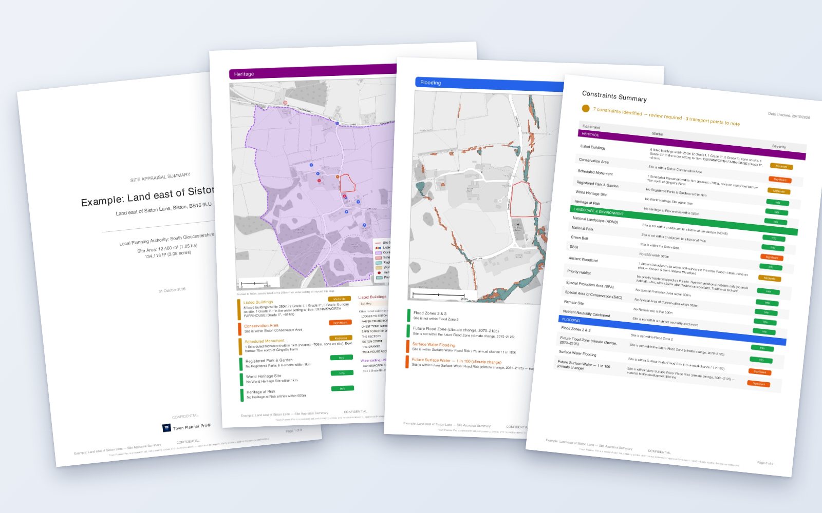
Not a lookup at a single point. Each constraint is measured from the red line, with its distance, its source and the date it was checked, and the whole record exports as a report under your practice name.
- Listed buildings by grade and distance, conservation areas, scheduled monuments
- Green belt, protected landscapes and habitats, and the farmland grade
- Flood zones and surface water with climate change; Critical Drainage Areas in London
- The station catchment, bus frequencies and the Framework’s transport tests
- The adopted plan and its review stage, and the appeals decided nearby with the letter a tap away
- A client-ready PDF under your own logo, synced to every device you work on
What it does
Five tools, one record of your work
The jobs of an ordinary working week: the site visit, the casework behind it, the appeal research, the plan it all sits against and the planning history around it. One site record flows through all five.
Assess
Site Appraisals
Draw the red line and the constraints and the appeals decided nearby assemble around the boundary in seconds; the planning history imports from the council register.
ExploreTrack
Casework
Every application, pre-app, appeal and condition on one board, with the deadlines in view. Drop in a letter or notice and the details are read in for you to check.
ExploreResearch
Appeal Intelligence
Every English appeal decision since 2016, with the Inspector’s letter wherever one was published: search the reasoning, read an authority’s record, follow the key case law.
ExploreMonitor
Policy & Plans
The new NPPF, the adopted and emerging plan for every authority you work in, and the housing land supply accepted at appeal across England.
ExploreHistory
Planning History
The councils’ digital planning registers on one map, from 2006 or from the year each begins. Choose an authority, then search its register by address, reference or the words of a proposal, filter by outcome, and see what has been decided around any site. Planning records go back to 1948: the council’s own files hold the complete history. The registers are being read in, council by council.
Try it in the appAlready paying for an appeals database, a mapping tool or a deadline spreadsheet? See how it compares.
Appeals intelligence
A decade of appeal decisions, mapped across England, one click straight to the Inspector's decision letter
Over 273,000 decisions since 2016, direct from the Planning Inspectorate, with the decision letter behind each wherever PINS published one. Search every word of the letters, read any authority's record, see what was decided around any site.
- Every authority’s record: allowed rates by development type and procedure
- Comparable decisions with the letter one tap away
- Costs decisions read separately: who applied, who paid, and why
- AI reads every letter we hold: main issues, reasoning, weight and housing land supply
Try the free planning appeal search
Contains public sector information licensed under the Open Government Licence v3.0.
Every decision is searchable, mapped or not. A pin appears only where the Inspectorate's own record carries a usable location: we plot what can be placed honestly rather than guessing. Authorities are counted as the Inspectorate files them: an authority abolished since 2019 keeps its own record, so there are more records than councils today.
This week at appealWeek to 10 November 2026#ThisWeekAtAppeal358 decisions, 28.2% allowedRead the week

Planning intelligence for professionals
Better information. Better applications. Better decisions.
The professional judgement stays yours. Free for 14 days, with no payment card needed.