 ®
®
For UK planning & development professionals
Planning intelligence for professionals
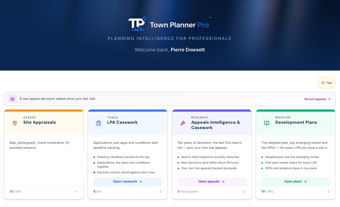
One system for the professional planner: appraise sites on the ground, keep your casework in view, research a decade of appeal decisions, and stay current on the plans and policy behind your advice.
Use on your mobile on site. Capture a site where you stand, on iPhone or iPad. Photographs, notes and the boundary save to the device first and sync to your account when you have signal.


Launching autumn 2026. Early access, no payment card, no commitment. Waiting-list members get 10% off their first year on an annual subscription.
What it does
Four tools, one record of your work
The jobs of an ordinary working week: the site visit, the casework behind it, the appeal research and the plan it all sits against. One site record flows through all four.
Assess
Site Appraisals
Walk a site, draw the red line, and constraints such as flood risk, heritage and landscape designations assemble around the boundary: key constraint information within seconds, not hours. Add the planning history and supporting maps, and read the appeals decided within the vicinity of your site.
Learn moreTrack
LPA Casework
Every application, pre-app, appeal and condition on one board, with the deadlines that bite in view. Drop in a registration letter, a decision notice or an email and the AI extracts the details and updates the casework, checked by you before it saves. A decision notice also reads its conditions into a client-facing schedule, noting which are pre-commencement and which need discharging.
Learn moreResearch
Appeals Intelligence & Casework
Monitor your own appeals as they run, and research the record around them: search for similar appeals, read the decision letter behind each, see the authority’s allowed rate for that development type, and follow the key case law through the live decisions applying it. New decisions arrive within days of publication.
Learn moreMonitor
Policy & Plans
National policy and the plan position for every authority you work in: the new NPPF searchable and citable, the adopted plan, the emerging review and the SPDs, with the housing land supply position as accepted at appeal. The policy context is already open when the appraisal starts.
Learn moreAppeals intelligence
A decade of appeal decisions, mapped across England, one click straight to the Inspector's decision letter
Over 260,000 decisions since 2016, direct from the Planning Inspectorate, with the decision letter behind each wherever PINS published one. Search every word of the letters, read any authority's record, see what was decided around any site.
- Every authority’s record: allowed rates by development type and procedure
- Comparable decisions with the letter one tap away
- Costs decisions read separately: who applied, who paid, and why
- AI reads the letters of the last five years: main issues, reasoning, weight and housing land supply
Contains public sector information licensed under the Open Government Licence v3.0.
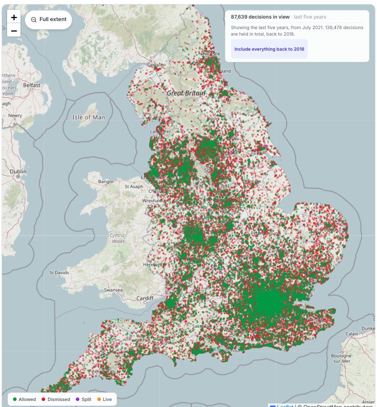
Every decision is searchable, mapped or not. A pin appears only where the Inspectorate's own record carries a usable location: we plot what can be placed honestly rather than guessing.
How it compares
What this replaces
Most planners already pay for part of this: an appeals database, a mapping tool, a spreadsheet of deadlines. Here is where each stops.
Every English appeal, with the decision letter wherever PINS published one
Every appeal decided around your site, read beside its constraints and development plan
Heritage answered against your boundary: listed buildings by grade and distance, conservation areas, scheduled monuments
Landscape and habitats answered, not just mapped: green belt, national landscapes, SSSIs, ancient woodland, European sites, nutrient catchments
Flood zones now and with climate change, from the Environment Agency's live data
The Framework's transport tests measured for the site: station catchment, service frequency, bus and cycle access
Housing land supply as accepted at appeal, dated against the plan
One red line drives it all: constraints, plan position, appeals and the report
Casework deadlines tracked on the same record
Use on your mobile on site: capture the site where you stand, saved to the device first and synced when you have signal
| What you need it to do | Appeal databases | Mapping & land tools | Town Planner Pro |
|---|---|---|---|
| Every English appeal, with the decision letter wherever PINS published one | Yes | No | Yes |
| Every appeal decided around your site, read beside its constraints and development plan | No | No | Yes |
| Heritage answered against your boundary: listed buildings by grade and distance, conservation areas, scheduled monuments | No | Partly | Yes |
| Landscape and habitats answered, not just mapped: green belt, national landscapes, SSSIs, ancient woodland, European sites, nutrient catchments | No | Partly | Yes |
| Flood zones now and with climate change, from the Environment Agency's live data | No | Partly | Yes |
| The Framework's transport tests measured for the site: station catchment, service frequency, bus and cycle access | No | No | Yes |
| Housing land supply as accepted at appeal, dated against the plan | No | No | Yes |
| One red line drives it all: constraints, plan position, appeals and the report | No | Partly | Yes |
| Casework deadlines tracked on the same record | No | No | Yes |
| Use on your mobile on site: capture the site where you stand, saved to the device first and synced when you have signal | No | Partly | Yes |
Planning intelligence for professionals
The finishing touches are going on now, ready for launch in autumn 2026. Join the waiting list and we will let you know the moment it opens. Waiting-list members get 10% off their first year on an annual subscription.