®
®Monitor
Policy & Plans
National policy and the development plan together: the new NPPF, searchable and citable, alongside the adopted plan, any emerging review and the SPDs for every authority you have a site in.
Your authorities, automatically
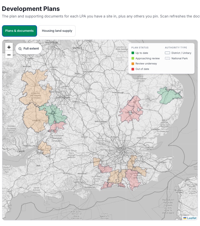
The monitor follows the authorities your sites are in. No setup, no firehose of all 340.
Plan status at a glance
Where each plan sits: emerging, at examination, adopted, and how old the adopted plan is against the five year review.
Milestones from the Inspectorate
Submission, examination and adoption dates drawn from the Planning Inspectorate’s own records for over 1,100 plans.
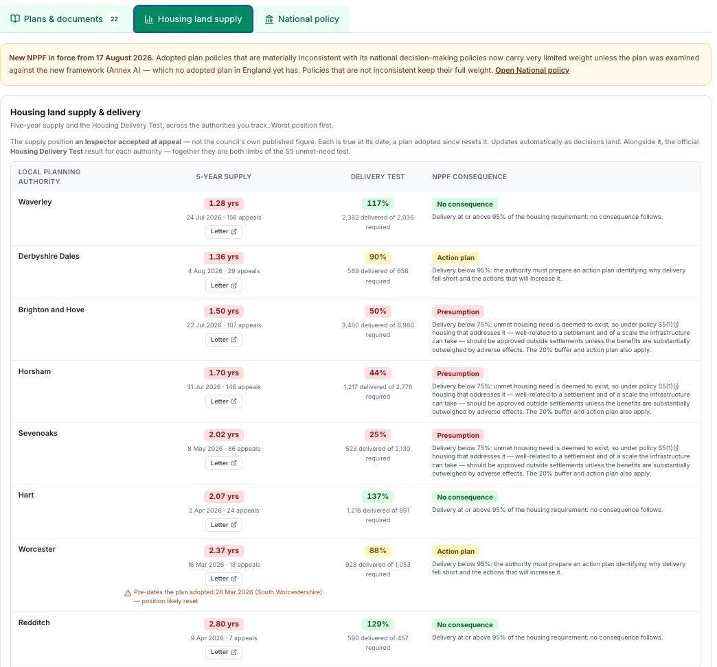
Supply tested at appeal
The housing land supply position Inspectors accepted for each authority, dated, from the appeal decisions themselves.
SPDs and evidence base
The documents behind each plan, gathered in one place.
The new NPPF, from day one
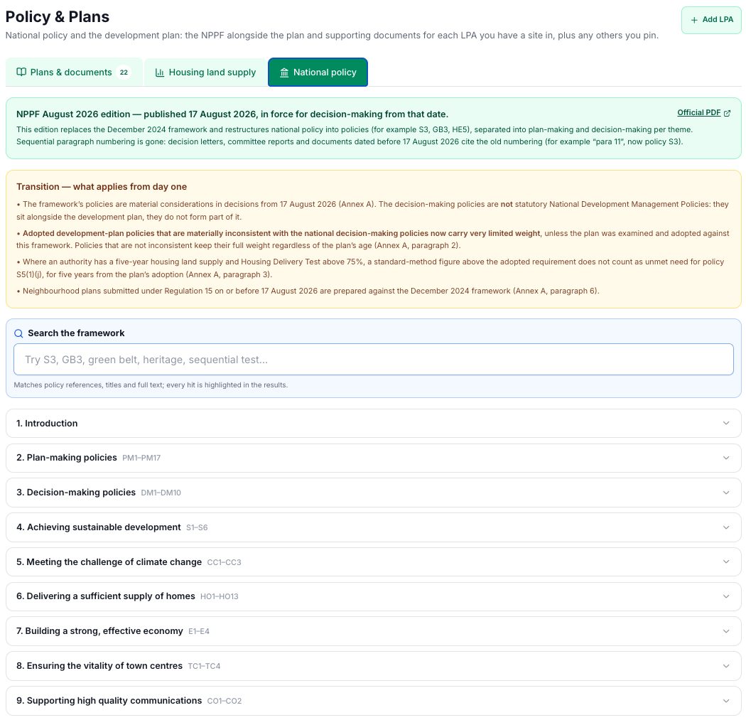
The Framework published on 17 August 2026 is in the app: every policy searchable and citable, the transition rules in plain terms, and the Chief Planner letters that explain them.
National policy
The new NPPF, searchable and citable from day one
The Framework published on 17 August 2026 restructures national policy into policies with stable references: S3, GB3, HE5. The app carries the full text, searchable by reference, title or any phrase, with the transition rules set out in plain terms: which adopted plan policies keep their weight, and what counts as unmet need from day one.
Documents dated before 17 August cite the old paragraph numbers; the app holds the new framework they now have to be read against.
Transport geography
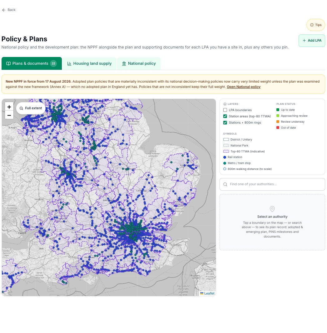
The station geography the Framework now turns on
The new NPPF ties density expectations to well-connected stations. The plans map carries the whole layer: rail, metro and tram stations with 800 metre walking catchments, inside the top-80 travel to work areas, across every authority you track. The same geography drives the transport checks on each site appraisal.